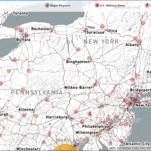
 Unmanned drones like quadcopters and fixed-wing aircraft are at the center of new airspace regulations by the FAA. While the FAA deliberates on rules and regulations, states, cities and other national organizations have implemented their own no-fly zones. To help find safe places to fly, the people at MapBox have created an awesome map of the established no-fly areas where drones are not permitted around all major airports, military bases, and national parks across the country. All the no-fly area data they collected to make these maps is now open data under CC-0. Go explore the map
The map represents areas where it is not recommended to fly drones due to regulations. Read more on their blog.